Flooding
Chronology: SW
Chronology: SW - Hayle
1849-09-08 South West
[1] Hayle district had a thunderstorm. Buildings were struck and set alight and a cow killed.
Rainfall: N/A
Source: N Devon Jour 13 Sep read more »
Historic Cornwall Flooding - Cornwall PFRA Annex5 June 2011
190922 | Par and St Blazey set to get cash boost to help protect against flooding
Cornish villages get cash boost to help protect against flooding

Published by Sarah Yeoman at 7:01am 22nd September 2019. (Updated at 7:39am 22nd September 2019) read more »
190708 | StARR river table helps show flood effects on landscape
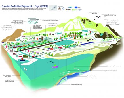
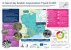
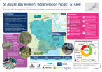
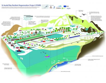
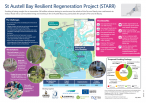
The St Austell Bay Resilient Regeneration (STARR) project
St Austell Bay Resilient Regeneration (StARR) Project
The St Austell Bay Resilient Regeneration (STARR) project aims to reduce flood risk to communities living and working in the St Austell Bay area, particularly in Par and St Blazey. The proposed scheme will bring additional benefits to the area by encouraging investment and making St Austell Bay a better place to work, live and play.
To progress the development of StARR we are working in partnership with: read more »
Flooding Cornwall
190129 | Will the authorities ever learn what causes those Subterranean Hayle Stink Blues?
Will the authorities ever learn what causes those Subterranean Hayle Stink Blues?
By Graham Smith
It is hardly news that much of West Cornwall is built on top of old mine workings. What makes this old news interesting in 2019 is the reluctance of a host of regulatory and commercial organisations to properly investigate, or understand, the consequences. read more »
The Angarrack Stream | Flood Profile for Hayle version 7, April 2018
The Angarrack Stream
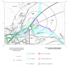
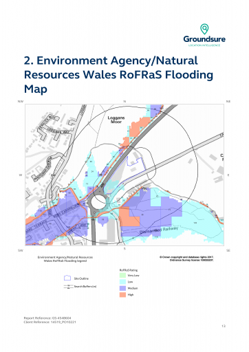
The Angarrack Stream flows into Copperhouse Pool and is tidal to Phillack. Flood risks are significant in the area around Marsh Lane and Loggans Mill roundabout, where the A30 is particularly vulnerable, and along the built up area between the roundabout and Copperhouse Pool. At times of high flow in the Angarrack Stream the Environment Agency pumps water from the pumping station upstream of Marsh Lane to further downstreamon the Angarrack River. read more »
Angarrack Flood Plan 2018
Note OCR used - please check original https://www.hayletowncouncil.net/wp-content/uploads/2018/04/Angarrack-fl... read more »
181001 | Copperhouse gate refurbishment
Copperhouse gate refurbishment will ensure Hayle continues to be protected from flooding
This autumn the Environment Agency will carry out refurbishment work on the Copperhouse Gate.
The gate is a critical part of the Angarrack Flood Alleviation Scheme which provides flood protection to 138 properties in the Copperhouse area of Hayle. The refurbishment will ensure that the existing level of flood defence is maintained for a further 30 years.
Work will be carried out by Environment Agency contractors BMMJV and will begin this November. Refurbishment of the gate will take approximately 7 weeks and during this time an area of the North Quay will not be accessible to the public. read more »
171221 | Extract from FLOOD RISK AND DRAINAGE ASSESSMENT FOR SHELL HAYLE AT CARWIN RISE , HAYLE , CORNWALL
Extract from FLOOD RISK AND DRAINAGE ASSESSMENT FOR SHELL HAYLE AT CARWIN RISE , HAYLE , CORNWALL report
3.0 FLOOD RISK ASSESSMENT
3.1 Assessment Approach
This assessment aims to minimise any impact of the development on flood risk through
adequate consideration of flooding issues and the inclusion of appropriate mitigation.
3.2 Fluvial Flood Risk
The development area, because of its proximity to a main river, is considered to be at
risk of fluvial flooding despite the presence of flood defences in the form of bunds that
have been constructed along both banks of the main river.
The map showing the local main rivers and other watercourses in the area is provided
in Appendix G. read more »
161024 | Helen on Twitter: "Here we go again, garden and garage flooded! #anyonewanttobuyahouse? https://t.co/ZF4BLCO75B
Helen on Twitter: "Here we go again, garden and garage flooded! #anyonewanttobuyahouse? https://t.co/ZF4BLCO75B
Here we go again, garden and garage flooded! #anyonewanttobuyahouse? pic.twitter.com/ZF4BLCO75B
— Helen (@Itstillhelen) October 24, 2016
160908 | National Flood Resilience Review (NFRR) report published by Defra and the Cabinet Office
Via http://www.metoffice.gov.uk/research/news/2016/national-flood-resilience...
Including:
The Met Office based these on recently recorded extreme events, and added substantial but plausible additional uplift s, of between 20% and 30% for each of the six standard climatological regions of England and Wales, determined from modelling and analysis of monthly rainfall records for these regions.
Role of climate change in past extreme rainfall and flooding events
[Page 36] read more »
160907 | Met Office science behind the National Flood Resilience Review
Via http://www.metoffice.gov.uk/research/news/2016/national-flood-resilience...
Met Office science behind the National Flood Resilience Review
September 2016 - As part of the National Flood Resilience Review, the Met Office was asked to estimate the potential likelihood and severity of record-breaking rainfall over the UK for the next 10 years. read more »
141119 | Cornwall Storm Impacts update 19 November 2014 V1.3
Viahttps://www.cornwall.gov.uk/media/10579670/Cornwall-Storm-Impacts-update-19-Nov-2014-V1-3.pdf
2.1.10 Flood Protection, Water Supply and Sewage Assets
Environment Agency owned and operated assets
During the winter the Devon & Cornwall Asset Performance and MEICA teams carried out several post
event asset inspections to monitor the integrity of the flood defences. The prolonged nationwide event
also prompted the Agency to request military assistance. read more »
160116 | UK flooding: How a Yorkshire town worked with nature to stay dry | Home News | News | The Independent
Via http://www.independent.co.uk/news/uk/home-news/uk-flooding-how-a-yorkshi...
UK flooding: How a Yorkshire town worked with nature to stay dry
Pickering pulled off protection by embracing the very opposite of what passes for conventional wisdom read more »
Flood alleviation ideas from other areas
Angarrack Gauge Levels 2014 to date...
There is an online gauge http://www.gaugemap.co.uk/#!Detail/8207/3553 see also Angarrack Screen Webcam these graphs show the level in previous years.

