- Jun 8: Let Senior Elf know if planning to attend Treasure Hunt and Afternoon Tea Sunday 14 June 2026 (2 days)
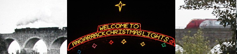
- Jun 12: Angarrack Christmas Lights open evening 5pm-9pm Friday 12th June 2026 (7 days)
- Jun 14: Treasure Hunt and Afternoon Tea, 2pm at Community Centre Sun 14 Jun 2026 (8 days)
- Jun 19: Mobile Library | Friday 19 Jun 2026 (14 days)
News aggregator
Covering pavement, parked for over 6 months, 5th June
Red Mazda S555 AVP been parked on entrance to estate for over 6 months. It has no MOT and has never been moved in the whole 6 months.

Report on FixMyStreet
Report on FixMyStreet
Categories: FixMyStreet
Covering pavement, parked for over 6 months, 5th June
Red Mazda S555 AVP been parked on entrance to estate for over 6 months. It has no MOT and has never been moved in the whole 6 months.
Report on FixMyStreet
Report on FixMyStreet
Categories: FixMyStreet
Punters think Cornwall pub is 'best Wetherspoons in UK' - Cornwall Live
Punters think Cornwall pub is 'best Wetherspoons in UK' Cornwall Live
Categories: Hayle News
Please see the Notice of Election for Hayle's Central Ward below
Please see the Notice of Election for Hayle's Central Ward below. This is the last remaining vacancy on the Town Council, so it's a great time to get involved in shaping the future of the town!
.
.
.
#localgovernment #BeaCouncillor #volunteer #JoinUs #towncouncil #hayle #cornwall

(Feed generated with FetchRSS)
.
.
.
#localgovernment #BeaCouncillor #volunteer #JoinUs #towncouncil #hayle #cornwall
(Feed generated with FetchRSS)
Please follow this link for the agenda:
Please follow this link for the agenda:
https://www.hayletowncouncil.gov.uk/wp-content/uploads/2026/05/4-June-Agenda-Final.pdf

(Feed generated with FetchRSS)
https://www.hayletowncouncil.gov.uk/wp-content/uploads/2026/05/4-June-Agenda-Final.pdf
(Feed generated with FetchRSS)
If you have any free events, classes or clubs taking place between 1st-7th June that we haven't mentioned, please feel free to a...
If you have any free events, classes or clubs taking place between 1st-7th June that we haven't mentioned, please feel free to add them in the comments ????????
Email info@hayletowncouncil.gov.uk to be featured on future versions of 'It's Happening Hayle'!
.
.
.
#hayle #cornwall #community #CommunityEvent #freeevents

(Feed generated with FetchRSS)
Email info@hayletowncouncil.gov.uk to be featured on future versions of 'It's Happening Hayle'!
.
.
.
#hayle #cornwall #community #CommunityEvent #freeevents
(Feed generated with FetchRSS)
???????????????????????????????? ????????????????????????????????????????????
???????????????????????????????? ????????????????????????????????????????????
Permit reference: G8042HYL005CCNETS-01
Contractor name: NETS
Street: VENTONLEAGUE HILL, HAYLE
Start date: 28/05/2026
End date: 01/06/2026
Traffic measure: Give and take

(Feed generated with FetchRSS)
Permit reference: G8042HYL005CCNETS-01
Contractor name: NETS
Street: VENTONLEAGUE HILL, HAYLE
Start date: 28/05/2026
End date: 01/06/2026
Traffic measure: Give and take
(Feed generated with FetchRSS)

Very large overhanging sycamore trees, 4th June
These trees are enormous. Branches low over pavement and overhanging garden. Look extremely dangerous in high winds. Beautiful trees but not near houses, lovely in woodland. Trees are on junction of Hawkins Road and Rawley Lane, Newquay
Report on FixMyStreet
Report on FixMyStreet
Categories: FixMyStreet
Public right of way blocked by rubbish and ladders, 4th June
This pathway is repeatedly being blocked and now has two large interlinked ladders going across it causing an obstruction to anyone wanting to use it
Report on FixMyStreet
Report on FixMyStreet
Categories: FixMyStreet
Public right of way blocked by rubbish and ladders, 4th June
This pathway is repeatedly being blocked and now has two large interlinked ladders going across it causing an obstruction to anyone wanting to use it
Report on FixMyStreet
Report on FixMyStreet
Categories: FixMyStreet
Children's tragic deaths prompt demand for safety barriers on A30 at Hayle - Cornwall Live
Categories: Hayle News
Children's tragic deaths prompt demand for safety barriers on A30 at Hayle - Cornwall Live
Categories: Hayle News
Children's tragic deaths prompt demand for safety barriers on A30 at Hayle - Cornwall Live
Categories: Hayle News
Children's tragic deaths prompt demand for safety barriers on A30 at Hayle - Cornwall Live
Categories: Hayle News
Celebrating 50 Years!
It’s amazing what can be achieved with positivity, dedication and hard work … town councillors and officers working together to make this happen. Special appreciation to our Facilities Team for their efforts.
Thank you once again to Suez Uk Environment Ltd and Sport England for their grant funding making our aims come to fruition.
#teamwork #AimHigh #communitysupport
(Feed generated with FetchRSS)
Thank you once again to Suez Uk Environment Ltd and Sport England for their grant funding making our aims come to fruition.
#teamwork #AimHigh #communitysupport
(Feed generated with FetchRSS)

